🚗 Recommended Plan: 11 Days / 10 Nights
This Seattle loop connects Olympic National Park, Mount Rainier National Park, Snoqualmie Falls, and North Cascades National Park, with Pacific beaches, temperate rainforest, waterfalls, alpine viewpoints, and the golden larches of Maple Pass.
🗺️ Core Route
Seattle → Port Angeles → Hurricane Ridge → Lake Crescent → Sol Duc → Hoh Rain Forest → La Push → Ruby Beach → Lake Quinault → Mount Rainier → Sunrise → Snoqualmie Falls → Diablo Lake → Maple Pass → Winthrop → Mount Baker → Deception Pass → Seattle
- 🛣️ Distance: roughly 1,000–1,150 miles including park roads
- ⏱️ Pure driving: 25–29 hours, excluding ferries, hikes and traffic
- 🚗 Vehicle: a normal sedan is sufficient
- ⛴️ Ferry: the Seattle–Bainbridge vehicle ferry is the scenic start
⚠️ Olympic has no central through-road — Hurricane Ridge, the Hoh, Sol Duc and the coast are separated by hours of driving.
Day 1
⛴️ Day 1 — Seattle → Port Angeles → Hurricane Ridge
| Item | Recommendation |
|---|---|
| ⛴️ Ferry | Seattle → Bainbridge Island |
| 🚘 Driving | ~2.5–3.5 hours, excluding ferry wait |
| 🛏️ Stay | Port Angeles |
| ⏰ Depart | Before 8 a.m. |
Take the ferry across Puget Sound, drive the peninsula's north shore and spend the afternoon up at Hurricane Ridge — the easiest alpine access in Olympic.
⚠️ Hurricane Ridge Road can close for weather, snow or parking capacity. Check the official road report before driving up.
- 1
 🐟 Pike Place MarketClear45°F / 7°C1–2 hours
🏙️ Start downtown at Seattle's Pike Place Market, then head to the nearby Colman Dock ferry terminal for the crossing to Bainbridge Island and the drive out to the Olympic Peninsula.
- 2
 Hurricane RidgeClear45°F / 7°C3–4 hours
🌄 Olympic's easiest alpine access.
🥾 Hurricane Hill Trail — ~3.4 mi / 700 ft round trip, 2–3 hours, 🟡 moderate — open subalpine terrain over the Olympics and the Strait of Juan de Fuca.
⚠️ Check the road report — Hurricane Ridge Road can close for weather or capacity.
Day 2
🏞️ Day 2 — Lake Crescent & Sol Duc Valley
| Item | Recommendation |
|---|---|
| 🚘 Driving | ~2.5–3.5 hours total |
| 🛏️ Stay | Port Angeles or Forks |
| ⏰ Start | ~7:30 a.m. |
A gentler day: Marymere Falls and the Lake Crescent shoreline in the morning, the Sol Duc Valley in the afternoon.
✅ Choose the very strenuous Mount Storm King or a relaxed Sol Duc afternoon — doing both overloads the day.
- 3
 Lake CrescentClear51°F / 11°C2–3 hours
🏞️ A deep glacial lake in old-growth forest — Lake Crescent Lodge and the Barnes Point shoreline.
🥾 Marymere Falls Trail — ~1.7 mi / 300 ft round trip, 1–1.5 hours, 🟢 easy to 🟡 moderate.
🥾 Optional: Mount Storm King — ~4.1 mi / 2,100 ft round trip, 3.5–5 hours, 🔴 very strenuous with rope-assisted sections — never in rain, wind or poor visibility.
- 4
 Sol Duc FallsClear52°F / 11°C1–1.5 hours
🥾 Sol Duc Falls Trail — ~1.6 mi / 200 ft round trip, 1–1.5 hours, 🟢 easy — an old-growth walk to Olympic's signature three-pronged waterfall.
Day 3
🌿 Day 3 — Hoh Rain Forest → Forks → La Push
| Item | Recommendation |
|---|---|
| 🚘 Driving | ~3–4 hours total |
| 🛏️ Stay | Forks or La Push |
| ⏰ Depart | Before 7 a.m. |
The Hoh entrance can queue for hours in summer — be there early. Resupply in Forks, then finish on the coast at La Push.
- 5
 Hoh Rain ForestClear56°F / 13°C3–5 hours
🌿 Moss-draped temperate rainforest — arrive early, summer entrance queues are real.
🥾 Hall of Mosses — ~0.8 mi loop, 30–60 minutes, 🟢 easy.
🥾 Spruce Nature Trail — ~1.2 mi loop, 45–75 minutes, 🟢 easy.
🥾 Hoh River Trail to Mineral Creek Falls — ~5.5 mi / 300 ft round trip, 2.5–3.5 hours, 🟡 moderate — when time allows.
- 6
 ForksClear49°F / 9°C30–45 minutes
🏘️ The west peninsula's service base — fuel, food and supplies before the coast.
- 7
 La PushClear45°F / 7°C1.5–2.5 hours
🥾 Second Beach Trail — ~2.1 mi / 300 ft round trip, 1.5–2.5 hours including beach time, 🟡 moderate — coastal forest down to sea stacks and a broad beach.
- Check tide tables before you go
- Respect Quileute tribal rules, private areas and closures
Day 4
🪨 Day 4 — Ruby Beach → Lake Quinault → Olympia
| Item | Recommendation |
|---|---|
| 🚘 Driving | ~4.5–6 hours with stops |
| 🛏️ Stay | Olympia |
| ⏰ Depart | ~7:30 a.m. |
Ruby Beach in the morning, the Quinault rainforest at midday, then continue to Olympia.
✅ Overnighting in Olympia avoids an unsafe after-dark drive into Mount Rainier.
- 8
 Ruby BeachClear48°F / 9°C1–1.5 hours
🪨 Sea stacks, driftwood and tide pools — Olympic's most photogenic roadside coast.
🥾 Ruby Beach Trail — ~1 mi / 100 ft round trip, 1–1.5 hours, 🟢 easy to 🟡 moderate.
- 9
 Lake QuinaultClear55°F / 13°C1.5–2 hours
🌲 The historic 1926 Lake Quinault Lodge and North Shore Road viewpoints.
🥾 Quinault Rain Forest Nature Trail — ~0.9 mi loop, 30–60 minutes, 🟢 easy.
Day 5
🌲 Day 5 — Olympia → Longmire & Paradise
| Item | Recommendation |
|---|---|
| 🚘 Driving | ~2.5–4 hours with park stops |
| 🛏️ Stay | Ashford, Longmire, Paradise or Packwood |
| 🚪 Entrance | Nisqually Entrance |
Work up the mountain slowly: Longmire's historic district, the roadside waterfalls, Reflection Lakes when the road is open, and Paradise in the afternoon.
🌼 Stay on hardened paths — the subalpine meadows are fragile.
- 10
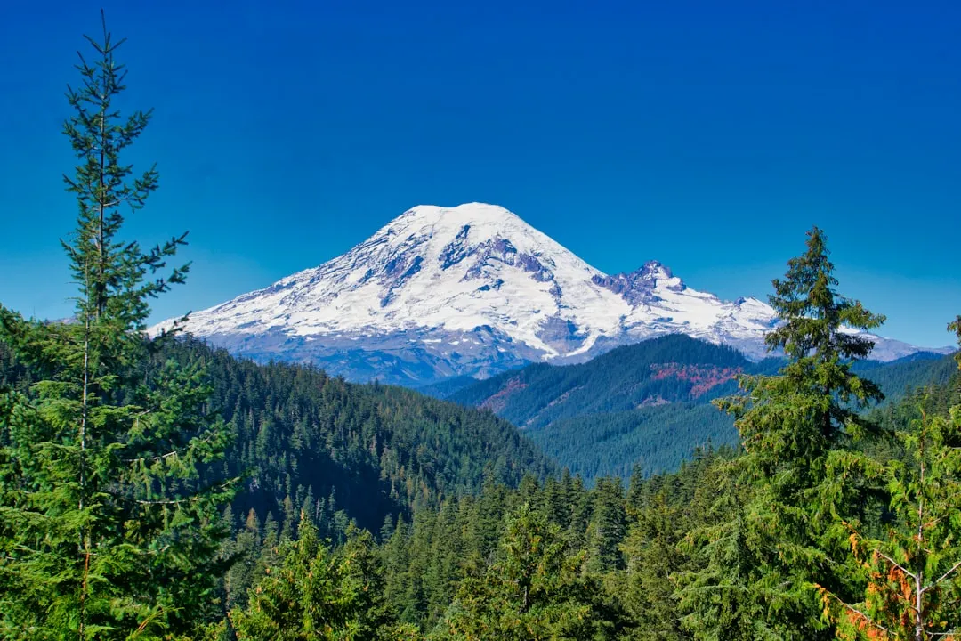
 Mount Rainier National ParkClear33°F / 1°Chalf a day
🌲 Ease into the park via the Nisqually Entrance:
- Longmire historic district
- Christine Falls & Narada Falls
- Reflection Lakes when the road is open
- Paradise visitor center & meadow viewpoints
🥾 Trail of the Shadows — ~0.7 mi loop, 30–45 minutes, 🟢 easy.
Day 6
🏔️ Day 6 — Skyline Loop at Paradise
| Item | Recommendation |
|---|---|
| 🚘 Driving | Minimal when staying nearby |
| 🛏️ Stay | Ashford, Paradise or Packwood |
| ⏰ Trail start | Before 7 a.m. |
The trip's signature hike. Snow can linger into July and afternoon storms build fast — start early and carry offline navigation.
- 11Mount Rainier National ParkClear33°F / 1°C4.5–6 hours
🥾 Skyline Trail Loop — 5.5 mi / 1,700 ft loop from Paradise, 4.5–6 hours, 🟠 strenuous.
- Myrtle Falls & subalpine meadows
- Panorama Point & the Nisqually Glacier
- Snow can linger into July — carry offline navigation
🥾 Easier alternative: Nisqually Vista Trail — ~1.2 mi / 200 ft loop, 45–75 minutes, 🟢 easy.
Day 7
🔭 Day 7 — Sunrise → Mount Fremont → Snoqualmie Falls
| Item | Recommendation |
|---|---|
| 🚘 Driving | ~4–5.5 hours total |
| 🛏️ Stay | North Bend or Snoqualmie |
| ⏰ Depart | Before 6:30 a.m. |
Drive around to the mountain's east side for the Sunrise area and the Mount Fremont Lookout, then transfer north with a Snoqualmie Falls stop.
- 12
 Sunrise (Mount Rainier)Clear40°F / 4°C3–4 hours
🥾 Mount Fremont Lookout Trail — 5.6 mi / 900 ft round trip from Sunrise, 3–4 hours, 🟡 moderate — Rainier's highest drivable point.
🥾 Shorter alternative: Sourdough Ridge — ~2.5 mi / 500 ft round trip, 1.5–2 hours, 🟡 moderate.
- 13
 Snoqualmie FallsClear48°F / 9°C45–90 minutes
💧 A 268-foot waterfall with a free, wheelchair-accessible upper viewpoint.
🥾 Optional lower trail — ~1.4 mi / 300 ft round trip, 1–1.5 hours, 🟡 moderate. Tired after Mount Fremont? The upper viewpoint is enough.
Day 8
💚 Day 8 — North Bend → Diablo Lake → Winthrop
| Item | Recommendation |
|---|---|
| 🚘 Driving | ~5–6.5 hours with stops |
| 🛏️ Stay | Winthrop or Mazama |
| 🛣️ Main road | State Route 20 |
The North Cascades Highway day: short stops at Newhalem, the Diablo Lake and Ross Lake overlooks, and Washington Pass. Reach Winthrop before dark.
🚧 SR 20 is seasonal and can close for snow, fire or rockfall — verify WSDOT status the morning you leave.
- 14
 Diablo LakeClear55°F / 13°C2–3 hours
💚 The turquoise heart of the North Cascades:
- Diablo Lake Vista Point (20–40 min)
- Short stops at Newhalem and the Ross Lake Overlook
🥾 Thunder Knob Trail — ~3.4 mi / 675 ft round trip, 2–2.5 hours, 🟡 moderate — when energy allows.
- 15
 Washington PassClear38°F / 3°C20–40 minutes
🏔️ Washington Pass Overlook — ~0.3 mi paved path, 20–40 minutes, 🟢 easy — a cliff-edge view of Liberty Bell Mountain and SR 20's hairpin.
- 16
 WinthropClear44°F / 7°Cevening
🤠 An Old-West themed Methow Valley town — dinner, fuel and your base for the Maple Pass day.
Day 9
🍁(Optional) Day 9 — Maple Pass & Golden Larches
| Item | Recommendation |
|---|---|
| 🚘 Driving | ~1.5–2 hours total from Winthrop |
| 🛏️ Stay | Winthrop or Mazama |
| ⏰ Start | At sunrise |
A dedicated day for one of Washington's strongest hikes — golden larches in late September, alpine lakes all summer. Parking at Rainy Pass fills before sunrise on peak fall weekends.
- 17
 Maple PassClear42°F / 6°C4.5–6.5 hours
🥾 Heather–Maple Pass Loop — ~7.2 mi / 2,000 ft loop from Rainy Pass, 4.5–6.5 hours, 🟠 strenuous.
- Alpine lakes, ridgelines and North Cascades peaks
- Golden larches in late September–early October
- Parking fills before sunrise on peak fall weekends
🥾 Easier alternative: Blue Lake Trail — ~4.4 mi / 1,050 ft round trip, 2.5–3.5 hours, 🟡 moderate.
Day 10
🗻(Optional) Day 10 — Winthrop → Mount Baker & Artist Point
| Item | Recommendation |
|---|---|
| 🚘 Driving | ~5.5–7 hours with stops |
| 🛏️ Stay | Bellingham |
| ⏰ Depart | ~7 a.m. |
Double back over the passes and up the Mount Baker Highway to Picture Lake and Artist Point.
❄️ Artist Point's upper road is seasonal — skip the detour when it's closed.
- 18
 Artist PointClear39°F / 4°C2–3 hours
🗻 Picture Lake and its Mount Shuksan reflection, then the road-end saddle.
🥾 Artist Ridge Trail — ~1.2 mi / 200 ft round trip, 45–75 minutes, 🟢 easy.
🥾 Optional: Chain Lakes Loop — ~7.1 mi / 1,800 ft loop, 4.5–6 hours, 🟠 strenuous — not after Maple Pass unless you want consecutive strenuous days.
❄️ Skip the detour when the seasonal upper road is closed.
Day 11
🌉 (Optional) Day 11 — Bellingham → Deception Pass → Seattle
| Item | Recommendation |
|---|---|
| 🚘 Driving | ~2.5–4 hours with stops |
| 🏁 Finish | Seattle |
| ⏰ Depart | 8–9 a.m. |
An easy final day: Deception Pass State Park, then south to Seattle with buffer for I-5 congestion.
- 19
 Deception PassClear44°F / 7°C1.5–2.5 hours
🌉 Bridge viewpoints over churning tidal water, plus West Beach and Bowman Bay.
🥾 Rosario Head Trail — ~1.5 mi / 200 ft round trip, 1–1.5 hours, 🟢 easy.
🌤️ Best Time to Travel
🥇 Late July–September: the best odds that Hurricane Ridge, Sunrise, Artist Point and the North Cascades Highway are all open, with long daylight — at the cost of crowds, full parking and possible wildfire smoke. 🍂 Late September–early October is the Maple Pass larch window, but Sunrise and Artist Point may already be closed. 💧 May–June has the strongest waterfalls, but high roads and trails stay snowbound.
🧳 Booking & Logistics
- 🏨 Reserve Forks, Mount Rainier, Winthrop and Bellingham lodging early.
- 🎟️ Mount Rainier has no timed entry in 2026, but Paradise and Sunrise parking fills — arrive before 7 a.m.
- 🌊 Download Olympic coast tide tables before beach hikes; a rising tide can trap you against headlands.
- 🗺️ Download offline maps — mobile coverage is unreliable in all three parks.
- 🚧 SR 20 (North Cascades Highway) is seasonal — verify WSDOT status right before travel.
✅ Final Recommendation
Spend 11 days / 10 nights between late July and September. Give Olympic four days, enter the Hoh early, split Mount Rainier into separate Paradise and Sunrise days, reserve a dedicated day for Maple Pass, and return through Deception Pass.
Take it with you
Mail this route to yourself
We’ll send the full day-by-day itinerary, photos and all, straight to your inbox.