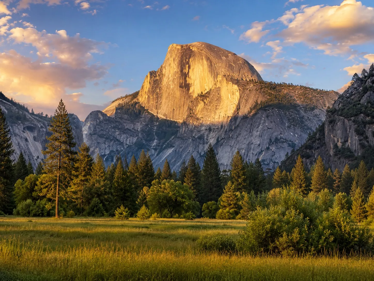
🚗 Recommended Plan: 4 Days / 3 Nights
This itinerary stays entirely within Yosemite National Park and covers the park's major regions without forcing every major hike into one exhausting schedule.
🗺️ Core Route
South Entrance → Mariposa Grove → Wawona → Tunnel View → Yosemite Valley → Glacier Point Road → Tioga Road → Tuolumne Meadows
- ⏳ Recommended duration: 4 days / 3 nights
- 🏔️ Best for: first-time visitors with a car
- 💧 Best overall season: late May through June for waterfalls
- 🌲 Best full-access season: July through September
- 🛏️ Recommended base: Yosemite Valley for at least two nights
- ⚠️ Important limitation: Glacier Point Road and Tioga Road are seasonal and may be closed by snow
⚠️ Distances inside Yosemite are deceptive. Mountain roads are slow, parking is limited, and a short distance on the map can require more than an hour of driving.
📊 Main Hike Summary
| Hike | Distance | Elevation gain | Typical time | Difficulty |
|---|---|---|---|---|
| Lower Yosemite Fall Loop | 1 mi / 1.6 km | 50 ft / 15 m | 30–60 min | 🟢 Easy |
| Cook's Meadow Loop | 1 mi / 1.6 km | Mostly flat | 30–60 min | 🟢 Easy |
| Bridalveil Fall Trail | 0.5 mi / 0.8 km | 80 ft / 24 m | 20–45 min | 🟢 Easy |
| Mirror Lake (out and back) | 2 mi / 3.2 km | 100 ft / 30 m | ~1 hr | 🟢 Easy |
| Mirror Lake (full loop) | 5 mi / 8 km | ~200 ft / 60 m | 2–3 hr | 🟡 Easy–moderate |
| Grizzly Giant Loop | 2 mi / 3.2 km | 300 ft / 90 m | 1.5–2 hr | 🟡 Moderate |
| Vernal Fall Footbridge | 1.6 mi / 2.6 km | 400 ft / 120 m | 1–1.5 hr | 🟡 Moderate |
| Top of Vernal Fall (Mist Trail) | 2.4 mi / 3.9 km | 1,000 ft / 300 m | ~3 hr | 🟠 Strenuous |
| Nevada Fall (Mist/JMT) | ~5–8 mi / 8–13 km | ~2,000 ft / 610 m | 5–8 hr | 🟠 Strenuous |
| Columbia Rock | ~2 mi / 3.2 km | ~1,000 ft / 305 m | 2–3 hr | 🟠 Strenuous |
| Upper Yosemite Fall | 7.2 mi / 11.6 km | 2,700 ft / 823 m | 6–8 hr | 🟠 Strenuous |
| Sentinel Dome | 2 mi / 3.2 km | 400 ft / 120 m | 1–2 hr | 🟡 Moderate |
| Taft Point | 2.2 mi / 3.5 km | 200 ft / 60 m on return | 1–2 hr | 🟡 Moderate |
| Four Mile Trail (round trip) | 9.6 mi / 15.5 km | 3,200 ft / 975 m | 6–8 hr | 🟠 Strenuous |
| Lembert Dome | 3.8 mi / 6.1 km | 850 ft / 260 m | 3–4 hr | 🟠 Moderate–strenuous |
| Cathedral Lakes | 7.6 mi / 12 km | 1,000 ft / 305 m | 6–7 hr | 🟠 Strenuous |
| May Lake | 2.4 mi / 3.9 km | 485 ft / 150 m | 1–2 hr | 🟡 Moderate |
| Half Dome | 14–16.4 mi / 22.5–26.4 km | ~4,800 ft / 1,463 m | 10–14+ hr | 🔴 Extremely strenuous |
Day 1
🌲 Day 1 — Mariposa Grove, Wawona & Tunnel View
| Item | Recommendation |
|---|---|
| 🚪 Entrance | South Entrance via Highway 41 |
| 🚘 Driving | ~1.5–3 hours inside the park |
| 🛏️ Stay | Yosemite Valley or Wawona |
| ⏰ Arrival | Before 9 a.m. |
🌲 Mariposa Grove of Giant Sequoias — 2–4 hours
Start with Yosemite's largest grove of giant sequoias.
Grizzly Giant Loop
- 📏 Distance
- 2 mi / 3.2 km round trip
- 📈 Elevation gain
- 300 ft / 90 m
- ⏱️ Time
- 1.5–2 hours
- 🎯 Difficulty
- 🟡 Moderate
- 📍 Start
- Mariposa Grove Arrival Area
Highlights: Bachelor and Three Graces, the Grizzly Giant, and the California Tunnel Tree. Continue into the upper grove only when you have 3–5 hours and are comfortable with a longer climb.
⚠️ The grove shuttle is seasonal. When it's unavailable, the Washburn Trail adds roughly 4 miles round trip and about 1,000 feet of climbing to reach and return from the grove.
🏡 Wawona — 1–2 hours
The Wawona Hotel area, the Pioneer Yosemite History Center, lunch or a short break, and an optional walk along the South Fork of the Merced River. Pleasant, but first-time visitors shouldn't sacrifice Yosemite Valley time for a long stop here.
🌄 Tunnel View — 30–60 minutes
Continue north on Wawona Road and stop at Tunnel View before entering the Valley for the classic view of El Capitan, Half Dome, Bridalveil Fall and Yosemite Valley. Best in late afternoon for warmer light, right after a storm for dramatic clouds, or at sunrise for fewer people.
✅ Once you secure a parking space in Yosemite Valley, leave the car parked and use the free shuttle, a bike, or walking paths.
- 1
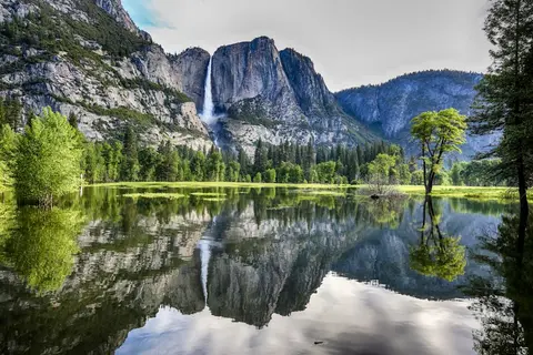 Yosemite National ParkPartly cloudy38°F / 3°C4 days / 3 nights
🏔️ Your basecamp for the whole trip. Granite giants — Half Dome, El Capitan — plus waterfalls, giant sequoias and the High Sierra. Park once in Yosemite Valley and explore by shuttle and on foot; the day-by-day plan below covers Mariposa Grove, the Valley, a Mist Trail or Falls hike, Glacier Point, and an optional Tioga Road day.
Day 2
🏞️ Day 2 — Yosemite Valley Highlights
| Item | Recommendation |
|---|---|
| 🚘 Driving | Minimal |
| 🚶 Activity | Walking, shuttle and short hikes |
| 🛏️ Stay | Yosemite Valley |
| ⏰ Start | 7–8 a.m. |
A collection of shorter hikes — you don't need to complete every stop.
💧 Lower Yosemite Fall Loop
- 📏 Distance
- 1 mi / 1.6 km loop
- 📈 Elevation gain
- ~50 ft / 15 m
- ⏱️ Time
- 30–60 minutes
- 🎯 Difficulty
- 🟢 Easy
🏞️ Cook's Meadow Loop
- 📏 Distance
- 1 mi / 1.6 km loop
- 📈 Elevation gain
- Mostly flat
- ⏱️ Time
- 30–60 minutes
- 🎯 Difficulty
- 🟢 Easy
🪨 El Capitan Meadow
Primarily a viewpoint rather than a defined hike — 0.5–1.5 miles of flexible walking, 30–60 minutes, 🟢 easy. Bring binoculars for the climbers on El Capitan.
💦 Bridalveil Fall Trail
- 📏 Distance
- 0.5 mi / 0.8 km round trip
- 📈 Elevation gain
- ~80 ft / 24 m
- ⏱️ Time
- 20–45 minutes
- 🎯 Difficulty
- 🟢 Easy
🪞 Mirror Lake
| Route | Distance | Elevation gain | Time | Difficulty |
|---|---|---|---|---|
| Short (out and back) | 2 mi / 3.2 km | ~100 ft / 30 m | ~1 hour | 🟢 Easy |
| Full loop | 5 mi / 8 km | ~200 ft / 60 m | 2–3 hours | 🟡 Easy–moderate |
🌅 For sunset, choose Sentinel Bridge for Half Dome reflections, Valley View for El Capitan and the Merced River, or Cook's Meadow for the easiest evening walk.
Day 3
🥾 Day 3 — Choose One Major Valley Hike
| Item | Recommendation |
|---|---|
| 🚘 Driving | Minimal |
| 🥾 Activity | One major hike |
| 🛏️ Stay | Yosemite Valley |
| ⏰ Start | Before 7 a.m. |
Pick one route based on fitness, weather, permits and trail conditions — do not combine the full Mist Trail, Upper Yosemite Fall and Half Dome.
Option A — Mist Trail Corridor
💦 Vernal Fall Footbridge
- 📏 Distance
- 1.6 mi / 2.6 km round trip
- 📈 Elevation gain
- 400 ft / 120 m
- ⏱️ Time
- 1–1.5 hours
- 🎯 Difficulty
- 🟡 Moderate
🌈 Top of Vernal Fall
- 📏 Distance
- 2.4 mi / 3.9 km round trip via the Mist Trail
- 📈 Elevation gain
- 1,000 ft / 300 m
- ⏱️ Time
- ~3 hours
- 🎯 Difficulty
- 🟠 Strenuous
⛰️ Nevada Fall
- 📏 Distance
- ~5–8 mi / 8–13 km round trip, route-dependent
- 📈 Elevation gain
- ~2,000 ft / 610 m
- ⏱️ Time
- 5–8 hours
- 🎯 Difficulty
- 🟠 Strenuous
Option B — Yosemite Falls Trail
🌄 Columbia Rock
- 📏 Distance
- ~2 mi / 3.2 km round trip
- 📈 Elevation gain
- ~1,000 ft / 305 m
- ⏱️ Time
- 2–3 hours
- 🎯 Difficulty
- 🟠 Strenuous
💧 Upper Yosemite Fall
- 📏 Distance
- 7.2 mi / 11.6 km round trip
- 📈 Elevation gain
- 2,700 ft / 823 m
- ⏱️ Time
- 6–8 hours
- 🎯 Difficulty
- 🟠 Strenuous
Option C — Easier Valley Day
| Valley Loop Trail | Distance | Time | Difficulty |
|---|---|---|---|
| Half loop | 7.2 mi / 11.6 km | 2.5–3.5 hours | 🟡 Moderate |
| Full loop | 11.5 mi / 18.5 km | 5–7 hours | 🟡 Moderate |
Day 4
🌄 Day 4 — Glacier Point Road
| Item | Recommendation |
|---|---|
| 🚘 Driving | ~2.5–4 hours total |
| 🥾 Hiking | One or two short hikes |
| 🏁 Departure | Return to the Valley or exit via Highway 41 |
| ⏰ Start | Before 8 a.m. |
🌄 Glacier Point Overlook
A short paved walk from the parking area (45–90 minutes including viewpoints), 🟢 easy — the main overlook route is wheelchair accessible. One of the park's best panoramas: Half Dome, the Valley, Yosemite Falls, Vernal and Nevada Falls and the High Sierra.
🥾 Sentinel Dome
- 📏 Distance
- 2 mi / 3.2 km round trip
- 📈 Elevation gain
- 400 ft / 120 m
- ⏱️ Time
- 1–2 hours
- 🎯 Difficulty
- 🟡 Moderate
🦅 Taft Point
- 📏 Distance
- 2.2 mi / 3.5 km round trip
- 📈 Elevation gain
- ~200 ft / 60 m on return
- ⏱️ Time
- 1–2 hours
- 🎯 Difficulty
- 🟡 Moderate
🔄 Sentinel Dome and Taft Point Loop combines both viewpoints into a ~4.5–5 mile / 7.2–8 km loop (~700–1,000 ft / 215–305 m, 3–4.5 hours, 🟡 moderate).
🧗 Alternative: Four Mile Trail from Yosemite Valley
- 📏 Distance
- 4.8 mi / 7.7 km one way; 9.6 mi / 15.5 km round trip
- 📈 Elevation gain
- 3,200 ft / 975 m
- ⏱️ Time
- 3–4 hours one way; 6–8 hours round trip
- 🎯 Difficulty
- 🟠 Strenuous
⚠️ Glacier Point Road is only open in the snow-free season. Falls from Taft Point are fatal — stay well back from the exposed edges.
Day 5
🏔️ Day 5 (Optional) — Tioga Road & Tuolumne Meadows
| Item | Recommendation |
|---|---|
| 🚘 Driving | ~4–6 hours with stops |
| 🛏️ Stay | Yosemite Valley, the Tuolumne area, or outside the east entrance |
| ⛽ Fuel | Fill up before the high country |
| ⏰ Start | 7–8 a.m. |
Add this day only when Tioga Road is open. Work east across the high country.
🏞️ Olmsted Point
A short viewpoint walk (20–40 minutes, 🟢 easy) for the view of Half Dome from behind.
🏖️ Tenaya Lake
A flexible shoreline walk, typically 0.5–2 miles with minimal elevation gain (45–90 minutes, 🟢 easy).
🥾 Optional High-Country Hikes
Lembert Dome
- 📏 Distance
- 3.8 mi / 6.1 km round trip
- 📈 Elevation gain
- 850 ft / 260 m
- ⏱️ Time
- 3–4 hours
- 🎯 Difficulty
- 🟠 Moderate–strenuous
Cathedral Lakes
- 📏 Distance
- 7.6 mi / 12 km round trip
- 📈 Elevation gain
- 1,000 ft / 305 m
- ⏱️ Time
- 6–7 hours
- 🎯 Difficulty
- 🟠 Strenuous
May Lake
- 📏 Distance
- 2.4 mi / 3.9 km round trip from the parking area
- 📈 Elevation gain
- 485 ft / 150 m
- ⏱️ Time
- 1–2 hours
- 🎯 Difficulty
- 🟡 Moderate
📵 No fuel and weak cell service in Tuolumne Meadows, plus afternoon thunderstorms and lingering snow into early summer. Download offline maps and pack extra water, food and warm layers.
Day 6
🧗 Day 6 (Optional) — Half Dome
🏔️ Half Dome via the Mist Trail
- 📏 Distance
- ~14–16.4 mi / 22.5–26.4 km round trip
- 📈 Elevation gain
- ~4,800 ft / 1,463 m
- ⏱️ Time
- Usually 10–14 hours; some hikers need longer
- 🎯 Difficulty
- 🔴 Extremely strenuous
- 📍 Start
- Happy Isles Trailhead
- 🎟️ Permit
- Required when the cables are installed
Half Dome is not part of the standard four-day itinerary. Add it only with a valid permit, when the cables are installed, weather is dry and stable, and every hiker is prepared for an endurance hike.
Suggested schedule
- 4:30–5:30 a.m. — start from Happy Isles
- Morning — Vernal Fall and Nevada Fall corridor
- Late morning — Little Yosemite Valley and the forest approach
- Midday — Subdome and cables, only if conditions remain safe
- Afternoon — begin the descent early enough to avoid darkness
- Evening — return to Yosemite Valley
Why it's optional
Lottery success isn't guaranteed, the cables create major exposure, wet granite is dangerous, and afternoon thunderstorms can make the summit unsafe. The route demands substantially more endurance than the other hikes.
✅ No permit? Use the day for Nevada Fall, the Four Mile Trail, or Upper Yosemite Fall instead.
🎟️ Half Dome Permit & Lottery
A permit is required to ascend the Half Dome cables whenever they're installed — weekends and weekdays alike. A general entrance pass, lodging or campground reservation, or ordinary day-use itinerary does not replace the Half Dome permit.
🥾 Day-Hiker Permits
Most day-hiking permits are distributed through two lotteries on Recreation.gov.
- 📅 Preseason lottery: applications normally open March 1–31, with results in April. This is the primary, reliable way to get a permit — apply under the permit holder's legal name.
- ⏱️ Daily lottery: apply two days before your hiking date; results come later that day. Treat it only as a fallback — there may be no permits for a given date.
- 🪪 ID: the named permit holder or a valid alternate must be present with government-issued photo ID. Permits can't be transferred to an unrelated hiker, and everyone past the Subdome checkpoint must be covered by the permit.
🎒 Backpacker Permits
A wilderness permit alone does not authorize Half Dome. Request Half Dome access as part of an eligible wilderness-permit application — backpacker Half Dome permits have a separate quota, and Little Yosemite Valley is highly competitive, so reserve early.
⚠️ Don't obtain an unrelated wilderness permit just to bypass the day-hiker lottery. Your trailhead, route and overnight itinerary must comply with the permit.
🗓️ Cable Season
The cables are generally installed from roughly late May through mid-October, but exact dates depend on weather, snow and park operations. A permit authorizes an attempt, not safe conditions — the cables may go up late or come down early, and snow, ice, lightning, rain or wildfire can make the route unsafe even with a valid permit.
❌ Winning the lottery does not justify climbing in unsafe conditions. Turn around for developing thunderstorms, wet granite, ice or snow, severe wind, exhaustion at Subdome, or insufficient water, food or daylight.
Official sources: day-hiker permits · backpacker permits · Half Dome details · lottery applications
🧳 Booking & Logistics
- 🎟️ Entrance reservations: Yosemite is not using a timed vehicle-reservation system in 2026, but lodging, camping and wilderness permits remain separate and can be hard to obtain.
- 🏕️ Camping: reserve as soon as the booking window opens.
- 🏨 Lodging: book in-park lodging months in advance.
- 🗺️ Navigation: download the NPS app and offline maps.
- ⛽ Fuel: fill up before long drives to Glacier Point or Tioga Road.
- 🧥 Weather: carry layers — high-elevation temperatures can be far colder than the Valley.
- 💧 Water: don't rely on seasonal water at remote trailheads.
- 🐻 Food storage: follow all bear-proof food-storage rules.
- 🚧 Road status: check current road, trail and weather conditions each morning.
⚠️ Major Failure Modes
- Starting too late — no parking, long shuttle lines, crowded trails, hiking in peak heat, and driving after dark.
- Planning around seasonal roads without verification — Tioga Road and Glacier Point Road can stay closed into late spring or early summer, and opening dates can't be predicted far ahead.
- Overloading the itinerary — a full Mist Trail hike, Glacier Point, Mariposa Grove and Tioga Road in one day is physically unrealistic and unsafe.
- Depending on cellular service — navigation, calls and data may fail outside developed areas.
- Underestimating elevation — the high country can bring headaches, shortness of breath and faster dehydration; slow down, hydrate, and don't plan your hardest hike right after arriving at altitude.
✅ Final Recommendation
Spend 4 days / 3 nights, stay in Yosemite Valley for at least two nights, enter via the South Entrance for Mariposa Grove, and stop at Tunnel View before dropping into the Valley. Park once and use the shuttle, dedicate one full day to the Mist Trail or Yosemite Falls Trail, and give one day to Glacier Point Road. Add Tioga Road only with a fifth day and an open road, and Half Dome only as an optional sixth day after obtaining a permit. Visit in late May or June for waterfalls, or July through September for the best chance of full park access.
Official planning: current conditions · seasons · waterfalls · Valley transportation · Tioga & Glacier Point road status
Take it with you
Mail this route to yourself
We’ll send the full day-by-day itinerary, photos and all, straight to your inbox.