🚗 Recommended Plan: 7 Days
One big loop through the Colorado Plateau, linking the Grand Canyon, the slot canyons around Page, Monument Valley, and Utah's five national parks.
🗺️ Core Route
Grand Canyon → Page → Monument Valley → Moab → Capitol Reef → Bryce Canyon → Zion
- 🛣️ Distance: roughly 1,000 miles
- 🏜️ Terrain: high desert — big temperature swings and little shade
- 🧭 Best strategy: save Zion for last, so the trip ends on its most dramatic canyon
Day 1
🏜️ Day 1 — Grand Canyon
| Item | Recommendation |
|---|---|
| 🛏️ Stay | Grand Canyon Village or Tusayan |
| 🚘 Driving | Minimal once you arrive |
| ⏱️ Time | Half to full day |
Walk a stretch of the South Rim Trail and catch sunset at Hopi or Mather Point. Ride the free shuttle out to Hermits Rest when the road is closed to cars.
- 1
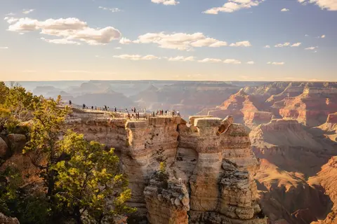 Grand CanyonOvercast68°F / 20°Chalf to full day
🏜️ South Rim highlights:
- Mather & Hopi Points
- Sunset over the canyon
🥾 Rim Trail — ~12.7 mi / 577 ft point-to-point, 4–5 hours end-to-end, 🟢 easy — flat and paved; most walk a short segment between viewpoints and ride the free shuttle back.
🥾 Below the rim: Bright Angel to 1.5-Mile Resthouse — ~3 mi / 1,120 ft round trip, 2–2.5 hours, 🟠 strenuous — the climb back out is all uphill; skip midday in summer.
Day 2
📸 Day 2 — Page: Horseshoe Bend & Antelope Canyon
| Item | Recommendation |
|---|---|
| 🚘 Driving | ~2.5 hours from the Grand Canyon |
| 🛏️ Stay | Page |
| 🎟️ Note | Antelope Canyon requires a booked Navajo-guided tour |
Horseshoe Bend is a short walk from the rim parking lot — go early or late for softer light. Time your Antelope Canyon tour for midday in spring and summer, when the light beams appear.
- 2
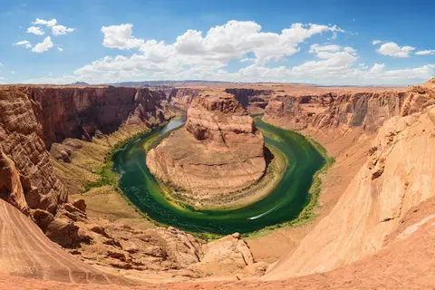 Horseshoe BendOvercast59°F / 15°C1 hour
📸 The Colorado River's dramatic 270° bend.
🥾 Horseshoe Bend Trail — ~1.5 mi / 137 ft round trip, ~30 minutes, 🟢 easy — a short sandy walk from the rim parking lot; little shade, go early or late for softer light.
- 3
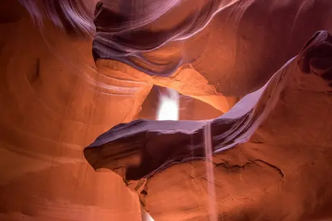 Antelope CanyonOvercast58°F / 14°C1.5 hours
🌀 A sculpted sandstone slot canyon — book a Navajo-guided tour for the midday light beams.
Day 3
🎬 Day 3 — Monument Valley
| Item | Recommendation |
|---|---|
| 🚘 Driving | ~2 hours from Page |
| 🛏️ Stay | Monument Valley (The View) or Mexican Hat |
| ⏰ Best light | Sunrise & sunset |
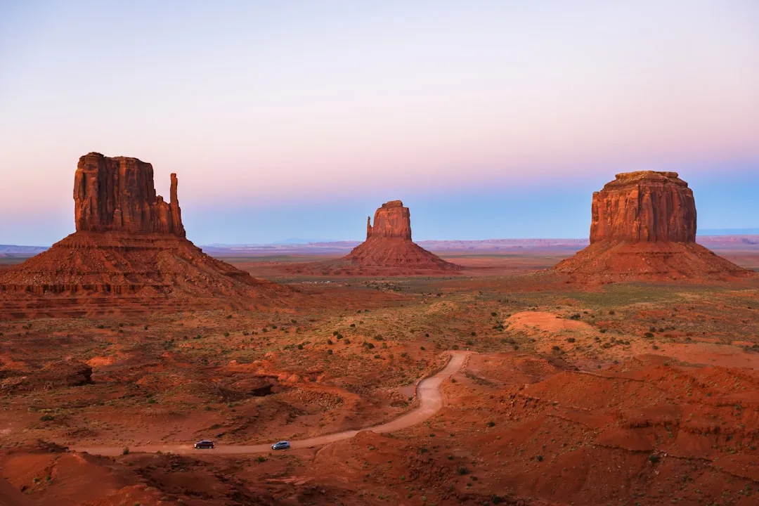
Drive the 17-mile Valley Drive loop among the buttes — a high-clearance vehicle helps — or hire a Navajo guide to reach the backcountry mittens and arches.
- 4
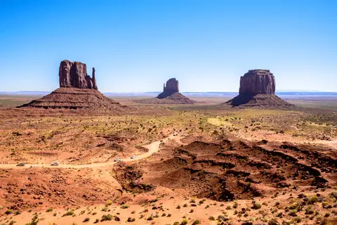 Monument ValleyOvercast52°F / 11°Chalf a day
🎬 The definitive Western landscape:
- The 17-mile Valley Drive loop (high-clearance helps)
- The Mittens at sunrise
- Forrest Gump Point
🥾 Wildcat Trail — ~4 mi / 393 ft loop, 1.5–2 hours, 🟡 moderate — the park's only self-guided hike, circling West Mitten Butte; loose sand and no shade.
Day 4
🧗 Day 4 — Moab: Arches & Canyonlands
| Item | Recommendation |
|---|---|
| 🚘 Driving | ~3 hours to Moab |
| 🛏️ Stay | Moab |
| 🥵 Heat | Start hikes at dawn in summer |
Catch Delicate Arch in the morning at Arches, then head to the Island in the Sky mesa at Canyonlands for the big overlooks. Both parks share the Moab gateway.
- 5
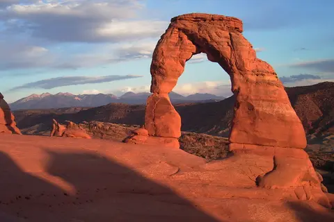 Arches National ParkPartly cloudy53°F / 12°Chalf a day
🧗 Arches highlights:
🥾 Delicate Arch Trail — ~3 mi / 629 ft round trip, 2–3 hours, 🟠 strenuous — steep open slickrock with exposure and no shade; best at sunrise or sunset.
🥾 Windows Loop & Turret Arch — ~1 mi / 150 ft loop, 30–60 minutes, 🟢 easy — three massive arches on one short loop.
🥾 Landscape Arch — ~1.9 mi / 160 ft round trip, ~1 hour, 🟢 easy — flat gravel to the park's longest arch.
- 6
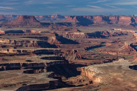 Canyonlands National ParkOvercast55°F / 13°Chalf a day
🏜️ Island in the Sky:
- Green River Overlook (roadside)
🥾 Mesa Arch Trail — ~0.6 mi / 55 ft loop, ~30 minutes, 🟢 easy — the iconic arch framing the canyons at sunrise.
🥾 Grand View Point Trail — ~2 mi / 219 ft round trip, 1–1.5 hours, 🟢 easy — a level walk to the mesa's tip; check for seasonal weekday closures.
Day 5
🍎 Day 5 — Capitol Reef
| Item | Recommendation |
|---|---|
| 🚘 Driving | ~2.5 hours from Moab |
| 🛏️ Stay | Torrey |
| 🍏 Don't miss | The historic Fruita orchards |
Drive the Scenic Drive past the Waterpocket Fold, hike to Hickman Bridge, and pick fruit in season at the Fruita orchards.
- 7
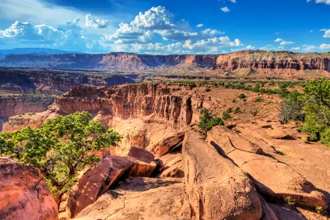 Capitol Reef National ParkOvercast48°F / 9°Chalf a day
🍎 Capitol Reef:
- The Scenic Drive along the Waterpocket Fold
- Fruita orchards (pick fruit in season)
🥾 Hickman Bridge Trail — ~1.8 mi / 416 ft round trip, 1–1.5 hours, 🟡 moderate — a self-guided climb to a 133-ft natural bridge.
Day 6
🔶 Day 6 — Bryce Canyon
| Item | Recommendation |
|---|---|
| 🚘 Driving | ~2.5 hours from Capitol Reef |
| 🛏️ Stay | Bryce Canyon City |
| 🥶 Elevation | 8,000+ ft — cold mornings even in summer |
Watch sunrise over the hoodoos from Sunrise or Inspiration Point, then drop into the amphitheater on the Navajo Loop / Queen's Garden trail.
- 8
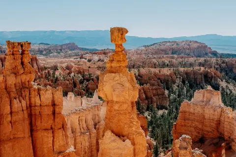 Bryce Canyon National ParkPartly cloudy42°F / 6°Chalf a day
🔶 Bryce highlights:
- Sunrise & Inspiration Points at first light
🥾 Queen's Garden & Navajo Loop — ~2.9 mi / 646 ft loop, 1.5–2 hours, 🟡 moderate — the classic descent through the hoodoos; the Wall Street side has seasonal weekday closures.
Day 7
🏞️ Day 7 — Zion
| Item | Recommendation |
|---|---|
| 🚘 Driving | ~1.5 hours from Bryce |
| 🛏️ Stay | Springdale |
| 🚌 Note | Zion Canyon runs on a shuttle most of the year |
Finish big: ride the shuttle up Zion Canyon and walk the Riverside Walk into The Narrows, or climb Angels Landing if you scored a permit.
- 9
 Zion National ParkOvercast57°F / 14°Cfull day
🏞️ Zion finale:
🥾 Riverside Walk — ~2.2 mi / 57 ft round trip, ~1 hour, 🟢 easy — paved path to the mouth of The Narrows.
🥾 Emerald Pools Trail — ~3 mi / 583 ft loop, 1.5–2 hours, 🟡 moderate — lower, middle and upper pools from Zion Lodge.
🥾 Angels Landing — ~5.4 mi / 1,488 ft round trip, 4–5 hours, 🔴 very strenuous — a chained Class-3 ridge with sheer drops; permit required (seasonal lottery).
🌤️ Best Time to Travel
🥇 April–May and September–October are ideal — warm days, cool nights and manageable crowds. ☀️ Summer is punishing in the low desert around Page and Moab; start hikes at dawn and carry plenty of water. ❄️ Winter brings snow and closures at higher elevations like Bryce (8,000+ ft).
🧳 Booking & Logistics
- 🎟️ Antelope Canyon is on Navajo land — you must book a guided tour in advance.
- 🏨 Reserve lodging in Moab, Page and near the Grand Canyon early; gateway towns fill up fast.
- 💧 Carry far more water than you think you need, and top up fuel at every town.
- 🕐 Mind the clocks — Arizona doesn't observe daylight saving, but the Navajo Nation does.
✅ Final Recommendation
Give yourself 7 days and travel in May or October. Start big at the Grand Canyon, overnight in Page for the slot canyons, and finish in Zion.
Take it with you
Mail this route to yourself
We’ll send the full day-by-day itinerary, photos and all, straight to your inbox.