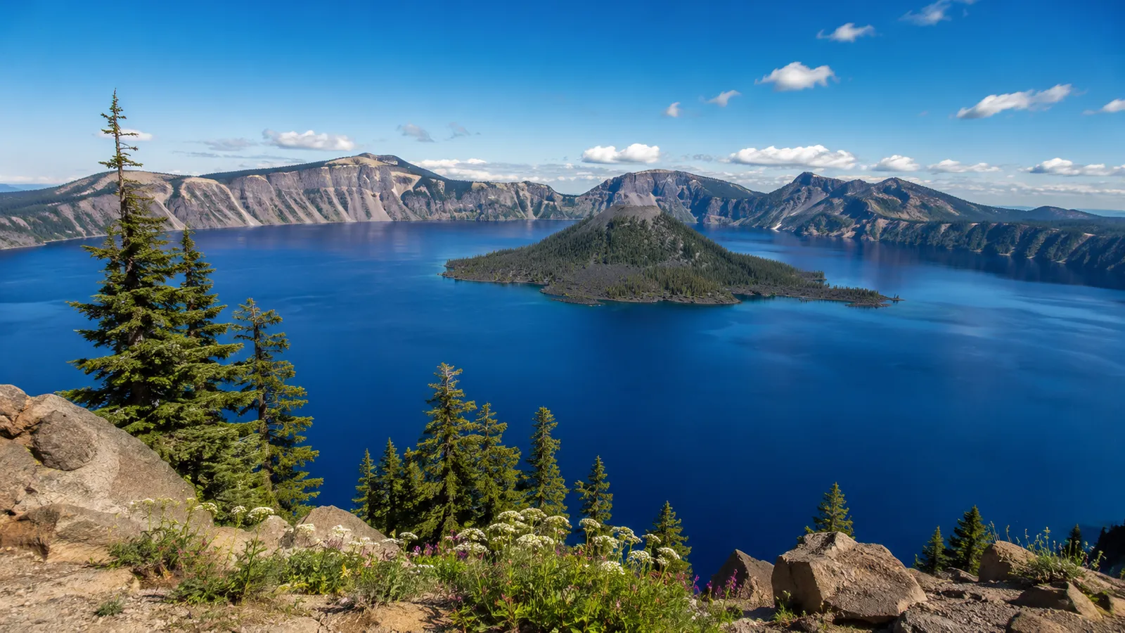
🚗 Recommended Plan: 8 Days / 7 Nights
This route connects Crater Lake, Mount Shasta, the alpine hike to Heart Lake, McCloud Falls, Burney Falls, Lassen Volcanic National Park, the rugged Mendocino Coast, Glass Beach, and finally San Francisco.
The plan avoids rushing the major parks. It includes one long transfer day between Lassen and the Mendocino Coast, while the remaining days are balanced around hiking, viewpoints, and scenic drives.
🗺️ Core Route
Crater Lake National Park → Mount Shasta → Castle Lake and Heart Lake → McCloud Falls → Burney Falls → Lassen Volcanic National Park → Fort Bragg → Glass Beach → Mendocino → Point Arena → Bodega Bay → San Francisco
- 🛣️ Distance: Approximately 750–850 miles, including park roads and scenic detours
- ⏱️ Pure driving: Approximately 18–21 hours, excluding sightseeing stops, hikes, meals, traffic, and road delays
- 🌞 Best overall season: Mid-July through September
- 💧 Best for waterfalls: Late May through June, but snow may restrict access around Crater Lake, Mount Shasta, and Lassen
- 🏔️ Best full-access window: Late July through September
- 🚗 Vehicle: A normal sedan is sufficient for the primary route
- ❄️ Primary limitation: Snow can close high-elevation roads and trails well into summer
⚠️ This trip crosses high mountains, volcanic terrain, remote highways, and the Northern California coast. Download offline maps and verify park conditions before every major driving day.
Day 1
🌋 Day 1 — Crater Lake National Park
| Item | Recommendation |
|---|---|
| 🚪 Entrance | South Entrance via OR-62 is generally the most reliable approach |
| 🚘 Driving | Approximately 1.5–3 hours inside the park |
| 🛏️ Stay | Crater Lake, Mazama Village, or nearby Prospect |
| ⏰ Arrival | Before 9:00 a.m. |
🌊 Rim Village and Sinnott Memorial Overlook
Start at Rim Village for the classic first view across Crater Lake.
Recommended:
- Sinnott Memorial Overlook
- Rim Village walking paths
- Crater Lake Lodge viewpoint
- Discovery Point area
- Sunset from the west rim
🥾 Discovery Point Trail
- 📏 Distance
- Approximately 2.1 mi / 3.4 km round trip
- 📈 Elevation gain
- Approximately 100 ft / 30 m
- ⏱️ Time
- 1–1.5 hours
- 🎯 Difficulty
- 🟢 Easy
- 📍 Start
- Rim Village
This is the best short introduction to the caldera rim without committing to a major hike.
🥾 Garfield Peak
- 📏 Distance
- Approximately 3.6 mi / 5.8 km round trip
- 📈 Elevation gain
- Approximately 1,010 ft / 308 m
- ⏱️ Time
- 2–3 hours
- 🎯 Difficulty
- 🟠 Moderate to strenuous
- 📍 Start
- Near Crater Lake Lodge
Garfield Peak provides elevated views across the lake and toward the surrounding Cascade Range.
⚠️ The trail is exposed to wind, sun, and rapidly changing mountain weather. Snow can remain into summer.
🚧 Seasonal and Construction Considerations
Crater Lake receives heavy snowfall. Rim Drive, trailheads, and the North Entrance do not open on fixed calendar dates.
For the 2026 season:
- Cleetwood Cove Trail is closed for rehabilitation
- Boat access is unavailable
- Part of East Rim Drive is closed for construction
- Some east-rim viewpoints and trailheads are inaccessible
Always use the current National Park Service conditions page rather than assuming the complete Rim Drive loop is open.
🌅 Sunset
Best options:
- Discovery Point
- Rim Village
- Watchman Overlook, when accessible
✅ Stay after sunset only when you are comfortable driving mountain roads in darkness and watching for wildlife.
- 1
 🌋 Crater Lake National ParkOvercast44°F / 7°CFull day
The whole first day belongs to the caldera rim — Rim Village, Discovery Point and Garfield Peak, with sunset from the west rim.
Day 2
🚗 Day 2 — Crater Lake → Mount Shasta
| Item | Recommendation |
|---|---|
| 🚘 Driving | Approximately 2.5–3.5 hours without long stops |
| 🛏️ Stay | Mount Shasta City |
| ⏰ Departure | Around 8:00–9:00 a.m. |
| 🛣️ Main route | OR-62 → US-97 → I-5 |
🌲 Optional Stop — Natural Bridge or Rogue River Gorge
When leaving through the south side of Crater Lake, consider one short stop near the upper Rogue River.
Spend approximately 30–60 minutes, not half a day, because Mount Shasta deserves the afternoon.
🌋 Mount Shasta City
Use the afternoon for:
- Downtown Mount Shasta
- Local cafés and outdoor shops
- Mount Shasta viewpoints
- Lake Siskiyou
- Preparing for the Heart Lake hike
🚶 Lake Siskiyou Trail — Partial Walk
The complete loop is longer than necessary for this itinerary. Walk only the most scenic section near the lake and Mount Shasta viewpoints.
- 📏 Distance
- Flexible, approximately 1–3 mi / 1.6–4.8 km
- 📈 Elevation gain
- Minimal
- ⏱️ Time
- 45 minutes–2 hours
- 🎯 Difficulty
- 🟢 Easy
- 📍 Start
- Lake Siskiyou day-use area
🌅 Sunset
Lake Siskiyou is one of the best easy-access sunset locations in the Mount Shasta area when the mountain is visible.
- 2
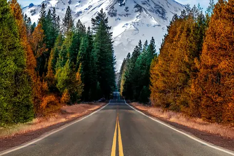 Mount ShastaOvercast51°F / 11°CAfternoon + evening
Browse the mountain town, then finish the day at Lake Siskiyou for the best easy-access sunset view of the volcano.
Day 3
❤️ Day 3 — Castle Lake & Heart Lake
| Item | Recommendation |
|---|---|
| 🚘 Driving | Approximately 30–45 minutes each way from Mount Shasta City |
| 🛏️ Stay | Mount Shasta City |
| ⏰ Start | Before 8:00 a.m. |
| 🎒 Main activity | Heart Lake hike |
❤️ Castle Lake to Heart Lake
- 📏 Distance
- Approximately 2.2 mi / 3.5 km round trip
- 📈 Elevation gain
- Approximately 600 ft / 183 m
- ⏱️ Time
- 1.5–2.5 hours
- 🎯 Difficulty
- 🟡 Moderate
- 📍 Start
- Castle Lake parking area
This short but steep hike provides one of the best views of Mount Shasta, Black Butte, and Castle Lake.
Route Notes
- Begin near the east end of the Castle Lake parking area
- The route climbs quickly above Castle Lake
- Some sections may be faint or confusing
- Continue to Heart Lake only on established public access
- Carry offline navigation
- Expect snow or mud early in the season
⚠️ Do not assume every visible social trail is legal or correct. Stay on the recognized route and respect private-property boundaries.
🏕️ Camping is prohibited within one-half mile of Castle Lake, including the Heart Lake area.
🏞️ Castle Lake Shoreline
After the hike, spend 30–60 minutes near Castle Lake for lunch or a short shoreline walk.
🌲 Optional Addition — Castle Crags State Park
Add Castle Crags only when you finish Heart Lake early and still have energy.
Vista Point Trail
- 📏 Distance
- Approximately 0.5 mi / 0.8 km round trip
- 📈 Elevation gain
- Minimal
- ⏱️ Time
- 20–40 minutes
- 🎯 Difficulty
- 🟢 Easy
- 📍 Start
- Vista Point parking area
This provides a quick view of the granite formations without adding another major hike.
✅ Do not combine Heart Lake with the full Castle Dome hike unless you intentionally want a long, strenuous hiking day.
- 3
 ❤️ Heart LakeOvercast50°F / 10°CHalf day
Park at Castle Lake and take the short, steep trail to Heart Lake for the signature Mount Shasta panorama.
Day 4
💧 Day 4 — McCloud Falls → Burney Falls → Lassen
| Item | Recommendation |
|---|---|
| 🚘 Driving | Approximately 3.5–5 hours including local roads |
| 🛏️ Stay | Manzanita Lake, Old Station, or near the Lassen northwest entrance |
| ⏰ Departure | Around 7:30–8:00 a.m. |
| 🛣️ Main route | CA-89 south |
💧 McCloud River Falls — Recommended Addition
McCloud Falls fits naturally between Mount Shasta and Burney Falls and is the strongest missing stop from the original route.
The waterfall corridor contains:
- Lower Falls
- Middle Falls
- Upper Falls
Middle Falls Overlook and Short Walk
- 📏 Distance
- Approximately 0.5–1.5 mi / 0.8–2.4 km, depending on route
- 📈 Elevation gain
- Low to moderate
- ⏱️ Time
- 30–75 minutes
- 🎯 Difficulty
- 🟢 Easy to 🟡 Moderate
- 📍 Start
- Middle Falls parking or nearby trail access
For this itinerary, drive between the principal viewpoints rather than hiking the entire river trail.
🌊 McArthur-Burney Falls Memorial State Park
| Item | Recommendation |
|---|---|
| ⏱️ Visit | 1.5–2.5 hours |
| 🚪 Hours | Day-use access generally begins at 8:00 a.m. |
| 🎟️ Reservation | May be required on peak summer dates |
| 🛏️ Overnight | Continue to the Lassen area |
Burney Falls is fed partly by underground springs, which helps maintain strong flow beyond the spring snowmelt season.
Falls Loop Area
- 📏 Distance
- Approximately 1 mi / 1.6 km, subject to current trail access
- 📈 Elevation gain
- Approximately 150 ft / 46 m
- ⏱️ Time
- 45–75 minutes
- 🎯 Difficulty
- 🟡 Easy to moderate
- 📍 Start
- Burney Falls day-use area
🚧 Trail access has changed during restoration projects. Confirm which routes and viewpoints are open before arrival.
🎟️ Reservation Warning
During the 2026 summer season, advance day-use reservations are required on specified high-demand dates, including summer weekends and major holidays.
Do not arrive expecting overflow roadside parking. Illegal parking creates safety problems and may result in being turned away.
🌅 Manzanita Lake
When you reach Lassen, stop at Manzanita Lake for sunset if daylight remains.
- 4
 McCloud FallsOvercast50°F / 10°C30–75 min
Drive between the Lower, Middle and Upper Falls viewpoints rather than hiking the full river trail.
- 5
 💧 Burney FallsPartly cloudy49°F / 9°C1.5–2.5 hours
Spring-fed and thundering even in late summer — walk the Falls Loop, and check whether a summer day-use reservation is required.
Day 5
♨️ Day 5 — Lassen Volcanic National Park
| Item | Recommendation |
|---|---|
| 🚪 Entrance | Northwest Entrance near Manzanita Lake |
| 🚘 Driving | Approximately 1–3 hours, depending on road access and stops |
| 🛏️ Stay | Manzanita Lake, Old Station, Mineral, or nearby lodging |
| ⏰ Start | Before 8:00 a.m. |
The full Lassen Volcanic National Park Highway is approximately 30 miles and normally requires at least one hour without stops. A realistic sightseeing day takes much longer.
🌄 Manzanita Lake Loop
- 📏 Distance
- 1.7 mi / 2.7 km loop
- 📈 Elevation gain
- Negligible
- ⏱️ Time
- Approximately 1 hour
- 🎯 Difficulty
- 🟢 Easy
- 📍 Start
- Manzanita Lake day-use area or Loomis Plaza
This is the park’s best easy walk for reflections and views of Lassen Peak and Chaos Crags.
🌋 Devastated Area Interpretive Trail
- 📏 Distance
- Approximately 0.5 mi / 0.8 km loop
- 📈 Elevation gain
- Minimal
- ⏱️ Time
- 30–45 minutes
- 🎯 Difficulty
- 🟢 Easy
- 📍 Start
- Devastated Area parking area
This short route explains the effects of Lassen Peak’s early twentieth-century eruptions.
♨️ Bumpass Hell
- 📏 Distance
- Approximately 3 mi / 4.8 km round trip
- 📈 Elevation gain
- Approximately 300 ft / 91 m, including descent and return climb
- ⏱️ Time
- 2–3 hours
- 🎯 Difficulty
- 🟡 Moderate
- 📍 Start
- Bumpass Hell parking area
Bumpass Hell is the park’s largest developed hydrothermal area.
⚠️ The trail usually opens later than lower-elevation routes because of snow. Stay on the boardwalk; hydrothermal ground can be thin and dangerously hot.
🌊 Optional Alternative — Kings Creek Falls
Choose Kings Creek Falls when Bumpass Hell is closed or when you prefer a waterfall hike.
- 📏 Distance
- Approximately 2.8 mi / 4.5 km round trip
- 📈 Elevation gain
- Approximately 500 ft / 152 m
- ⏱️ Time
- 2–3 hours
- 🎯 Difficulty
- 🟡 Moderate
- 📍 Start
- Kings Creek picnic area
🌋 Sulphur Works
Spend 20–40 minutes at this roadside hydrothermal area near the southwest entrance.
❌ Do not attempt Manzanita Lake, Bumpass Hell, Kings Creek Falls, and Lassen Peak in one day. Choose one primary hike.
🚧 Seasonal Road Risk
The park highway may remain closed to through traffic into summer after heavy snow years. The northwestern Manzanita Lake area and southwestern visitor-center area can be accessible separately before the road fully opens.
Verify:
- Highway status
- Trail snow
- Wildfire closures
- Smoke conditions
- Hydrothermal trail access
- 6
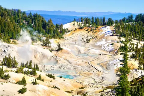 🌋 Lassen Volcanic National ParkOvercast41°F / 5°CFull day
Drive the 30-mile park highway past Manzanita Lake, the Devastated Area and Bumpass Hell — pick one primary hike, not three.
Day 6
🛣️ Day 6 — Lassen → the Mendocino Coast
| Item | Recommendation |
|---|---|
| 🚘 Driving | Approximately 5.5–7 hours without major delays |
| 🛏️ Stay | Fort Bragg or Mendocino |
| ⏰ Departure | By 7:30 a.m. |
| ⚠️ Day type | Long transfer day |
This is the hardest driving day of the itinerary.
The direct route crosses remote Northern California terrain before reaching US-101 and CA-20. Expect winding roads, limited services, and slower travel than navigation estimates suggest.
☕ Stop Strategy
Plan only brief stops for:
- Fuel
- Coffee
- Lunch
- Driver rest
Do not add a major hike to this day.
🌊 Arrival on the Mendocino Coast
When staying in Fort Bragg:
- Walk the coastal trail
- Visit Noyo Harbor for dinner
- Save Glass Beach for the next morning
When staying in Mendocino:
- Walk through the village
- Visit the headlands near sunset
- Drive to Glass Beach the following morning
✅ Fort Bragg is more practical. Mendocino has the better evening atmosphere.
Day 7
🌊 Day 7 — Glass Beach & Mendocino
| Item | Recommendation |
|---|---|
| 🚘 Driving | Approximately 30–90 minutes locally |
| 🛏️ Stay | Fort Bragg or Mendocino |
| ⏰ Start | Around 8:00 a.m. |
| 🌊 Main focus | Mendocino Coast |
🟢 Glass Beach and Fort Bragg Coastal Trail
- 📏 Distance
- Approximately 1–3 mi / 1.6–4.8 km, depending on turnaround
- 📈 Elevation gain
- Minimal
- ⏱️ Time
- 1–2 hours
- 🎯 Difficulty
- 🟢 Easy
- 📍 Start
- Glass Beach or Fort Bragg Coastal Trail access
Important Expectation
Glass Beach is historically significant and visually unusual, but visitors should not expect every cove to be completely covered in brightly colored glass.
🚫 Do not collect sea glass. Removing it damages the site and reduces what remains for future visitors.
🌲 Recommended Addition — Russian Gulch State Park
Russian Gulch adds redwoods, a waterfall, a beach, and dramatic coastal geology.
Headlands and Devil’s Punchbowl
- 📏 Distance
- Flexible, approximately 1–2 mi / 1.6–3.2 km
- 📈 Elevation gain
- Low
- ⏱️ Time
- 45 minutes–1.5 hours
- 🎯 Difficulty
- 🟢 Easy
- 📍 Start
- Russian Gulch headlands area
Fern Canyon and Waterfall Route
- 📏 Distance
- Approximately 6 mi / 9.7 km round trip
- 📈 Elevation gain
- Approximately 600–800 ft / 183–244 m
- ⏱️ Time
- 3–4 hours
- 🎯 Difficulty
- 🟡 Moderate
- 📍 Start
- Russian Gulch State Park
Choose the waterfall hike only when trail conditions are good and you are willing to dedicate most of the afternoon.
🌿 Mendocino Headlands
- 📏 Distance
- Flexible, approximately 1–4 mi / 1.6–6.4 km
- 📈 Elevation gain
- Minimal
- ⏱️ Time
- 1–2.5 hours
- 🎯 Difficulty
- 🟢 Easy
- 📍 Start
- Multiple access points around Mendocino village
The headlands provide sea arches, cliffs, hidden coves, and one of the best sunset walks on the route.
🌅 Sunset
Recommended:
- Mendocino Headlands
- Point Cabrillo area
- Fort Bragg Coastal Trail
- 7
 🌊 Glass BeachOvercast50°F / 10°C1–2 hours
Morning light on the sea-glass coves and the Fort Bragg Coastal Trail. Leave every piece of glass where it lies.
- 8
 🌊 Mendocino Headlands State ParkOvercast51°F / 11°C1–2.5 hours
Blufftop paths, sea arches and hidden coves around the village — the best sunset walk of the whole route.
Day 8
🌉 Day 8 — Highway 1 into San Francisco
| Item | Recommendation |
|---|---|
| 🚘 Driving | Approximately 5–7 hours with scenic stops |
| 🏁 Final destination | San Francisco |
| ⏰ Departure | Around 8:00 a.m. |
| 🛣️ Main route | Highway 1 south |
Highway 1 is slow and winding. Do not calculate this day using distance alone.
🗼 Point Arena Lighthouse — Optional
Spend 45–90 minutes at the lighthouse and surrounding coastal viewpoints.
This is a worthwhile stop when visibility is good. Skip it during heavy fog when you are already behind schedule.
🌊 Salt Point State Park — Optional
Use Salt Point for a short coastal break rather than a long hike.
Short Coastal Walk
- 📏 Distance
- Flexible, approximately 1–2 mi / 1.6–3.2 km
- 📈 Elevation gain
- Low
- ⏱️ Time
- 45–90 minutes
- 🎯 Difficulty
- 🟢 Easy
- 📍 Start
- Selected Highway 1 day-use area
🐋 Bodega Head
- 📏 Distance
- Approximately 1.7 mi / 2.7 km loop
- 📈 Elevation gain
- Approximately 250 ft / 76 m
- ⏱️ Time
- 1–1.5 hours
- 🎯 Difficulty
- 🟡 Easy to moderate
- 📍 Start
- Bodega Head parking area
Bodega Head offers open-ocean views and seasonal whale-watching opportunities.
🌉 Optional Final Stop — Golden Gate Viewpoint
When daylight and traffic allow, finish with a Golden Gate Bridge viewpoint before entering central San Francisco.
Options:
- Battery Spencer
- Golden Gate Overlook
- Baker Beach
- Crissy Field
🚦 Avoid reaching central San Francisco during the weekday afternoon commute when possible.
- 9
 🗼 Point Arena LighthouseOvercast53°F / 12°C45–90 min
Worth the detour when visibility is good; skip it in heavy fog if you're running behind schedule.
- 10
 🌊 Bodega HeadOvercast55°F / 13°C1–1.5 hours
A short bluff loop with open-ocean views and seasonal whale watching before the final run down Highway 1.
- 11
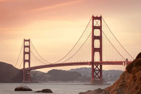 🌉 Golden Gate BridgeOvercast56°F / 13°CSunset finish
Finish at Battery Spencer or Baker Beach for the classic Golden Gate arrival shot before rolling into the city.
🌤️ Best Time for This Trip
🥇 Best Overall: Late July–September
Advantages:
- Best probability that Crater Lake roads are open
- Better access to Heart Lake
- Lassen highway and Bumpass Hell are more likely to be open
- Long daylight
- Drier coastal weather
Tradeoffs:
- Wildfire smoke is possible
- Burney Falls reservations may be required
- Popular areas are crowded
- Inland temperatures can be hot
💧 Late May–June
Advantages:
- Strong waterfalls
- Green landscapes
- Fewer peak-summer visitors
Major risks:
- Snow-covered Heart Lake trail
- Crater Lake Rim Drive closures
- Lassen highway closure
- Bumpass Hell closure
- Muddy trails
⚠️ This itinerary does not work as written when the high-elevation roads remain closed.
🍂 Late September–Early October
Advantages:
- Fewer crowds
- Cooler inland temperatures
- Clearer hiking conditions when wildfire smoke is absent
- Pleasant Mendocino Coast weather
Risks:
- Shorter daylight
- Early mountain snow
- Reduced services
- Cold nights
❄️ Winter and Early Spring
Not recommended for this complete route.
Crater Lake, Heart Lake, and Lassen become winter-travel destinations requiring different equipment, experience, and route planning.
🛏️ Recommended Overnight Distribution
| Night | Location | Reason |
|---|---|---|
| Night 1 | Crater Lake or Prospect | Early access to Crater Lake |
| Night 2 | Mount Shasta City | Lake Siskiyou and town access |
| Night 3 | Mount Shasta City | Dedicated Heart Lake hiking day |
| Night 4 | Manzanita Lake or Lassen area | Sunset and early park access |
| Night 5 | Manzanita Lake, Mineral, or nearby | Full Lassen day |
| Night 6 | Fort Bragg or Mendocino | Recovery after long transfer |
| Night 7 | Fort Bragg or Mendocino | Full coastal exploration day |
| Final | San Francisco | End of route |
⚡ Condensed Six-Day Version
| Day | Route |
|---|---|
| Day 1 | Crater Lake |
| Day 2 | Crater Lake → Mount Shasta |
| Day 3 | Heart Lake → Burney Falls → Lassen |
| Day 4 | Lassen → Fort Bragg |
| Day 5 | Glass Beach → Mendocino → Bodega Bay |
| Day 6 | Bodega Bay → San Francisco |
This version is possible but inferior.
You lose:
- McCloud Falls or substantial time there
- A full Lassen day
- Flexibility for trail or road closures
- A relaxed Mendocino Coast day
❌ Do not use the six-day version when hiking Heart Lake and Bumpass Hell are both priorities.
🧳 Booking and Logistics
- 🚗 Rental car: A standard sedan is sufficient for the primary route.
- ⛽ Fuel: Refill before leaving Mount Shasta, Burney, Lassen, and larger coastal towns.
- 🗺️ Navigation: Download offline maps for Crater Lake, Heart Lake, Lassen, and the coast.
- 🏨 Lodging: Reserve Crater Lake, Mount Shasta, Lassen, and Mendocino Coast accommodations early.
- 🎟️ Burney Falls: Check whether a summer day-use reservation is required.
- 🚧 Crater Lake: Verify Rim Drive, North Entrance, and trail closures.
- 🌋 Lassen: Verify the park highway, Bumpass Hell, snow, and wildfire conditions.
- 🔥 Wildfire season: Check fire closures, air quality, and smoke forecasts daily.
- 🐻 Food storage: Follow bear-safe storage rules in mountain areas.
- 🌊 Coastal safety: Stay back from cliffs and never turn your back on the ocean.
- 📵 Cellular service: Assume coverage will be unreliable in several sections.
- 🧥 Clothing: Carry layers for mountain cold, inland heat, and coastal wind on the same trip.
⚠️ Major Failure Modes
Planning the Trip Too Early in the Season
High-elevation roads and trails may still be inaccessible even when lower elevations are warm.
Underestimating the Lassen-to-Mendocino Drive
This is a long, tiring transfer on winding roads. Start early and rotate drivers when possible.
Arriving at Burney Falls Without a Reservation
On reservation-required dates, the park may turn away vehicles.
Treating Glass Beach as a Collection Site
Removing glass damages the protected coastal environment.
Depending on Mobile Navigation at Heart Lake
The trail can be faint. Save the route offline and verify that you are following legal public access.
Overloading the Lassen Day
Pick one primary hike. Adding multiple strenuous routes creates fatigue and late driving.
Ignoring Wildfire Conditions
Smoke, fire closures, and evacuation activity can invalidate the route with little notice.
✅ Final Recommendation
For the best balance:
- 🗓️ Spend 8 days / 7 nights
- 🌞 Travel from late July through September
- 🏔️ Spend two nights in Mount Shasta
- ❤️ Hike Heart Lake early in the morning
- 💧 Add McCloud Falls between Mount Shasta and Burney Falls
- 🎟️ Reserve Burney Falls access when required
- 🌋 Spend one complete day in Lassen
- 🌊 Spend two nights on the Mendocino Coast
- 🌿 Add Mendocino Headlands and Russian Gulch
- 🐋 Drive Highway 1 through Point Arena and Bodega Bay
- 🌉 Finish in San Francisco
🔗 Official Planning Sources
Crater Lake National Park
- Current conditions: https://www.nps.gov/crla/planyourvisit/conditions.htm
- Operating seasons and roads: https://www.nps.gov/crla/planyourvisit/hours.htm
- Cleetwood Cove closure: https://www.nps.gov/crla/planyourvisit/cleetwood-cove.htm
Mount Shasta and Heart Lake
- Heart Lake: https://www.fs.usda.gov/r05/shasta-trinity/recreation/heart-lake
- Castle Lake: https://www.fs.usda.gov/r05/shasta-trinity/recreation/castle-lake
- Mount Shasta area: https://www.fs.usda.gov/r05/shasta-trinity/recreation/mount-shasta-area
Burney Falls
- McArthur-Burney Falls Memorial State Park: https://www.parks.ca.gov/?page_id=455
- Summer reservation information: https://www.parks.ca.gov/post/102
Lassen Volcanic National Park
- Current conditions: https://www.nps.gov/lavo/planyourvisit/conditions.htm
- Trail conditions: https://www.nps.gov/lavo/planyourvisit/trail-conditions.htm
- Park highway: https://www.nps.gov/thingstodo/driveparkhwy.htm
- Bumpass Hell: https://www.nps.gov/thingstodo/hikebumpasshell.htm
- Manzanita Lake: https://www.nps.gov/thingstodo/walkmanzanitalake.htm
Mendocino Coast
- MacKerricher State Park: https://www.parks.ca.gov/?page_id=436
- Mendocino Headlands: https://www.parks.ca.gov/mendocinoheadlands
- Russian Gulch State Park: https://www.parks.ca.gov/?page_id=432
- Van Damme State Park: https://www.parks.ca.gov/VanDamme
Take it with you
Mail this route to yourself
We’ll send the full day-by-day itinerary, photos and all, straight to your inbox.