Mount Shasta
California
🚗 Check available routes: 🌋 Crater Lake → San Francisco Scenic Road Trip
📍 Location: Northern California, Cascade Range
🗓️ Best time to visit: June through September for sightseeing and hiking; May through mid-July for climbing
⏳ Recommended stay: 1–2 days
🌐 Official website: U.S. Forest Service — Mount Shasta Area
🌋 About Mount Shasta
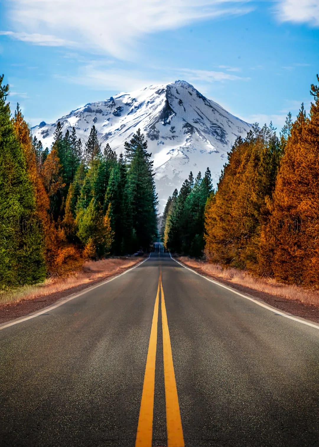
Mount Shasta is a massive, snow-covered stratovolcano in Northern California. Its summit reaches 14,179 feet (4,322 meters), making it one of California’s highest and most recognizable mountains.
The mountain is part of the Shasta–Trinity National Forest, while its upper slopes are protected within the Mount Shasta Wilderness.
Visitors come for scenic views, hiking, camping, mountain lakes, waterfalls, snow recreation, photography, and mountaineering.
✨ Why Visit
Mount Shasta is especially known for:
- 🏔️ Dramatic snow-covered mountain scenery
- 🌋 Volcanic landscapes
- 🌲 Forests and wilderness trails
- 💧 Mountain lakes, rivers, and waterfalls
- 🌼 Summer wildflowers
- 🌌 Excellent stargazing
- ❄️ Snowshoeing and backcountry skiing
- 🧗 Challenging summit routes
📅 Best Months to Visit
☀️ June–September — Best for General Visits
Summer and early fall usually provide the best access for scenic drives, hiking, camping, and photography.
- June: Green scenery, waterfalls, and lingering snow
- July: Warmer weather and better high-elevation access
- August: Dry conditions, but wildfire smoke is possible
- September: Cooler temperatures and fewer visitors
🧗 May–Mid-July — Best for Climbing
The usual climbing season on the south and west sides runs from May through mid-July, though conditions vary by snowpack.
There is no maintained hiking trail to the summit. The popular Avalanche Gulch route involves roughly 7,000 vertical feet of climbing and requires mountaineering skills and equipment.
Check the current Mount Shasta climbing advisory before attempting any summit route.
❄️ November–April — Winter Season
Winter activities include:
- Snowshoeing
- Cross-country skiing
- Backcountry skiing
- Winter photography
- Snow play near developed areas
Winter climbing involves serious avalanche, navigation, and weather hazards.
🚗 Access
The city of Mount Shasta is located near Interstate 5.
The main mountain access road is Everitt Memorial Highway, which leads toward:
- Bunny Flat
- Sand Flat
- Panther Meadow
- Old Ski Bowl
Upper sections of the highway are seasonal and may remain closed by snow until summer.
Bunny Flat is the main year-round access point for many hiking, skiing, and climbing routes, although winter storms may temporarily affect access.
🎟️ Permits
A free Mount Shasta Wilderness Permit is required when entering the wilderness.
Anyone traveling above 10,000 feet must also carry a Mount Shasta Summit Pass. The current standard pass costs $25 per person and is valid for up to three days.
Review the official permit information before traveling.
⚠️ Climbing Safety
Climbing Mount Shasta is a serious mountaineering objective, not a normal hike.
Hazards include:
- Steep snow and ice
- Rockfall
- Avalanches
- High winds
- Whiteout conditions
- Altitude illness
- Rapid weather changes
Depending on the route and season, climbers may need a helmet, crampons, an ice axe, navigation tools, avalanche equipment, and self-arrest skills.
Use the Mount Shasta Avalanche Center for current climbing, snow, avalanche, and weather information.
🔥 Wildfire and Smoke
Wildfire smoke can reduce visibility and air quality during summer and fall.
Before traveling, check:
- Current Shasta–Trinity National Forest conditions
- Forest alerts and closures
- Air-quality forecasts
- Fire restrictions
- Road and trail conditions
🐾 Pets
Pets are generally allowed in many national forest recreation areas unless otherwise posted.
Dogs should remain under control and must typically be leashed in developed recreation areas.
Hot volcanic rock, snow, sharp terrain, long distances, and limited water can create risks for pets.
✅ Before You Go
Check current official information for:
- 🚧 Road and trail closures
- ❄️ Snow and climbing conditions
- 🌨️ Avalanche forecasts
- 🔥 Wildfire and smoke
- 🎟️ Wilderness and summit permits
- 🏕️ Campground availability
- 🌬️ Mountain weather